
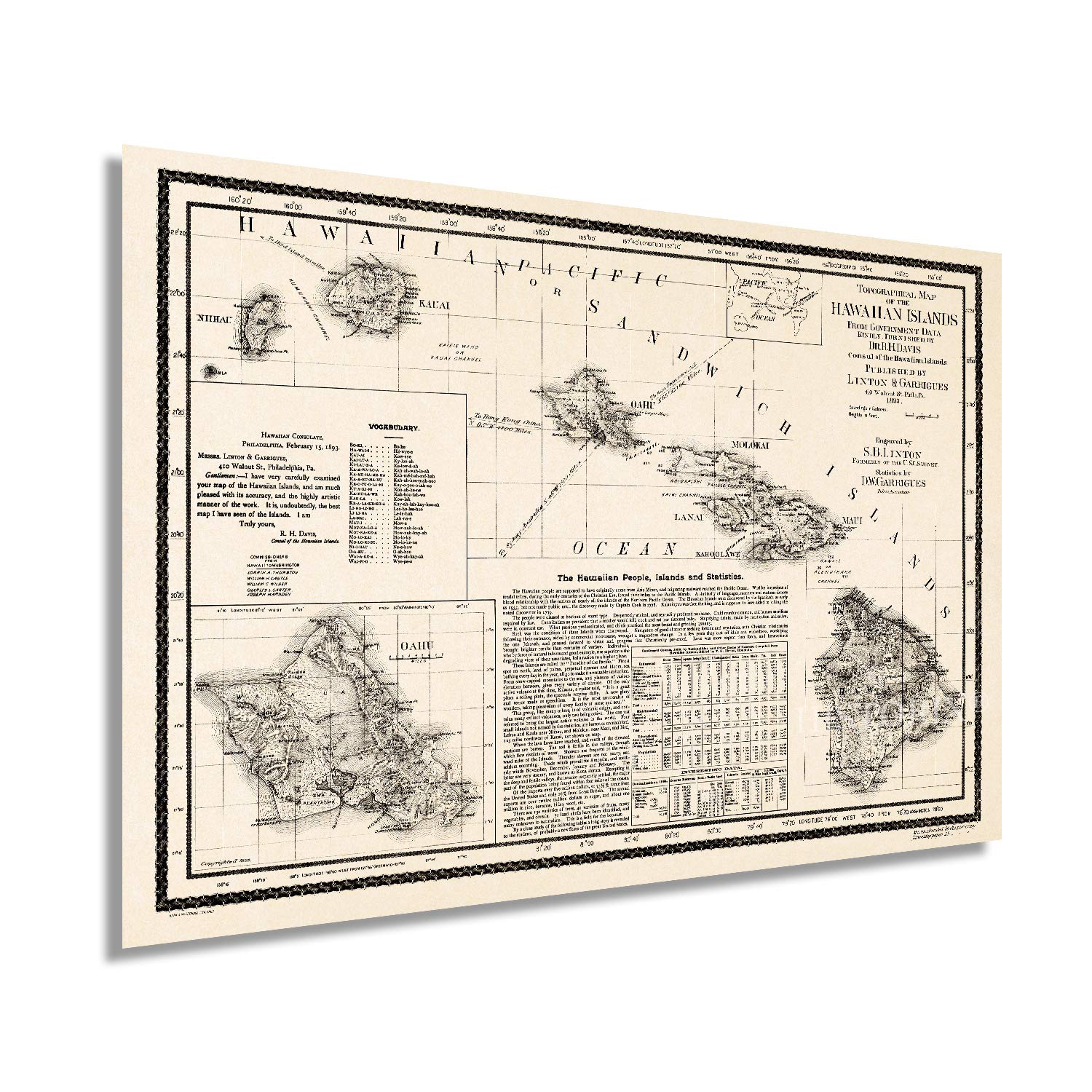


Size:16x24 Inch The 1890s were a time of significant transition for the Hawaiian Islands, and the depiction of the iconic archipelago in this 1893 publication transports the viewer back in time. Printed just five years before The United States would annex the island chain, the area was already being transformed by a thriving sugarcane farming industry, and vast fortunes were being made. 1893 marked the overthrowing of the last monarch following her attempt to ratify a new constitution granting her absolute authority, and a provisional government was formed.This map was published before the five years when Hawaii was recognized as a sovereign nation, one of two states in the Union to have done so. The Islands were first documented in 1778 by British explorer Captain James Cook and were dubbed The Sandwich Islands. Cook was killed by natives on the island in 1779 following a dispute over the theft of a small ship.The storied history of the islands has captivated American tourists for years, and tourism has always been a primary economic driver. The 1890s saw advances in sea travel, and the ability to quickly cross vast oceans opened the islands up to visitors. Tales spread through mainland America after authors Mark Twain and Jack London experienced the local tradition of ‘wave sliding’ or surfing.This topographical map represented the vanguard of depth maps, with soundings being laboriously produced by vessels in coastal waters and surveyors using the latest technology to indicate the heights of the mountain; this an authentic piece of cartographical history.Our museum quality giclee print comes printed with archival ink on premium heavyweight matte paper. Shipped in a sturdy cardboard tube your print will arrive ready to be framed. This eye-catching vintage map print makes the perfect gift for anyone that loves history and imagery.
Trustpilot
1 week ago
2 weeks ago