
🗺️ Chart Your Course to Adventure!
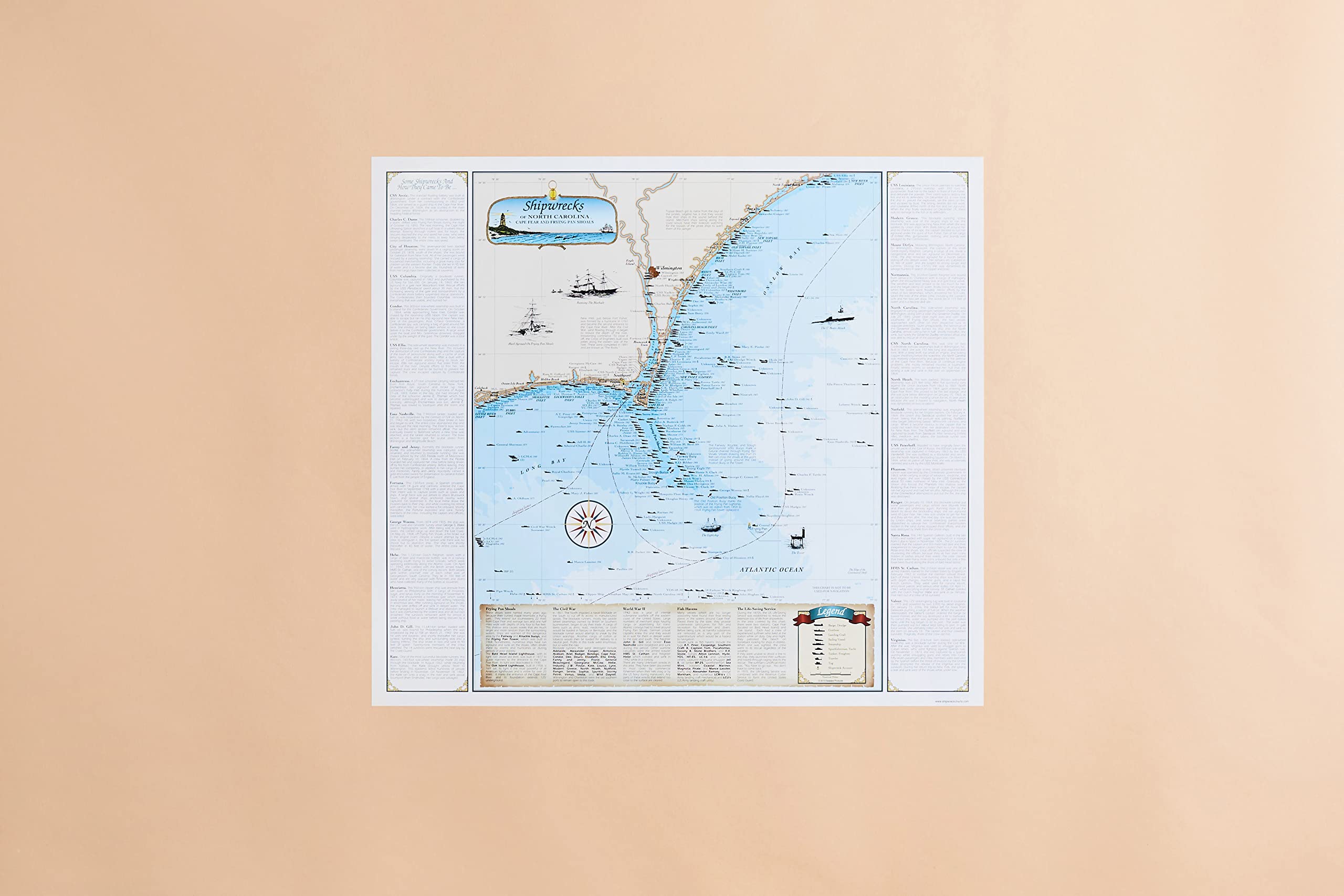
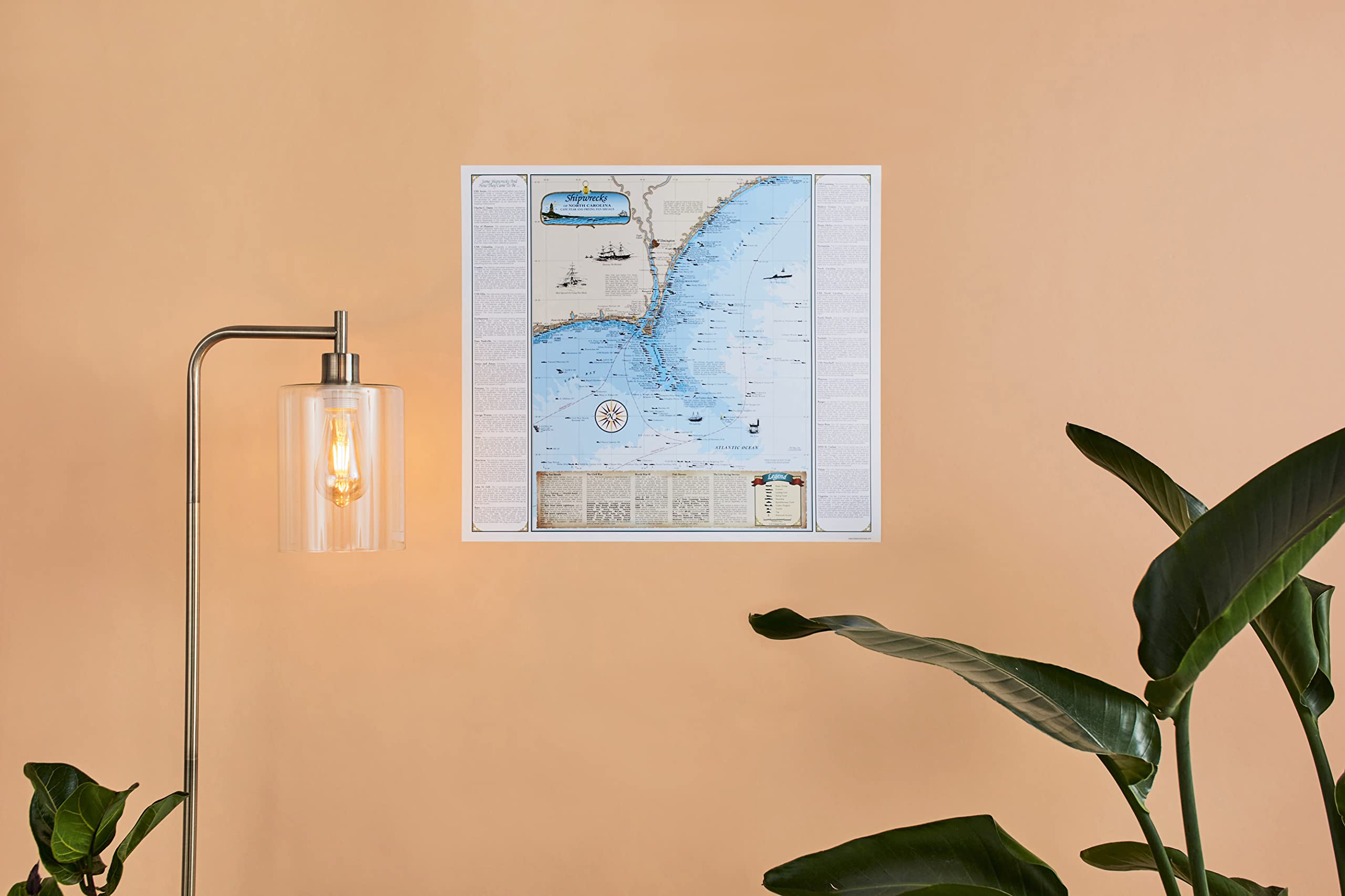
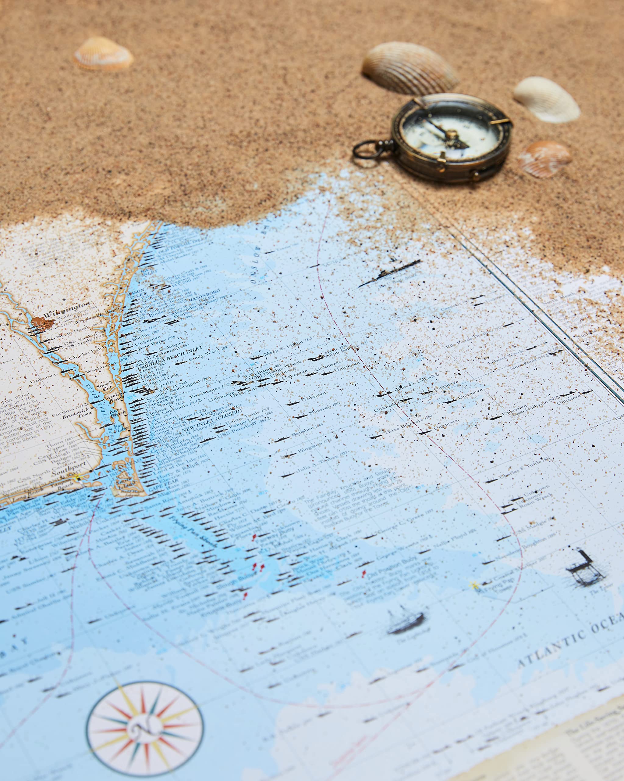
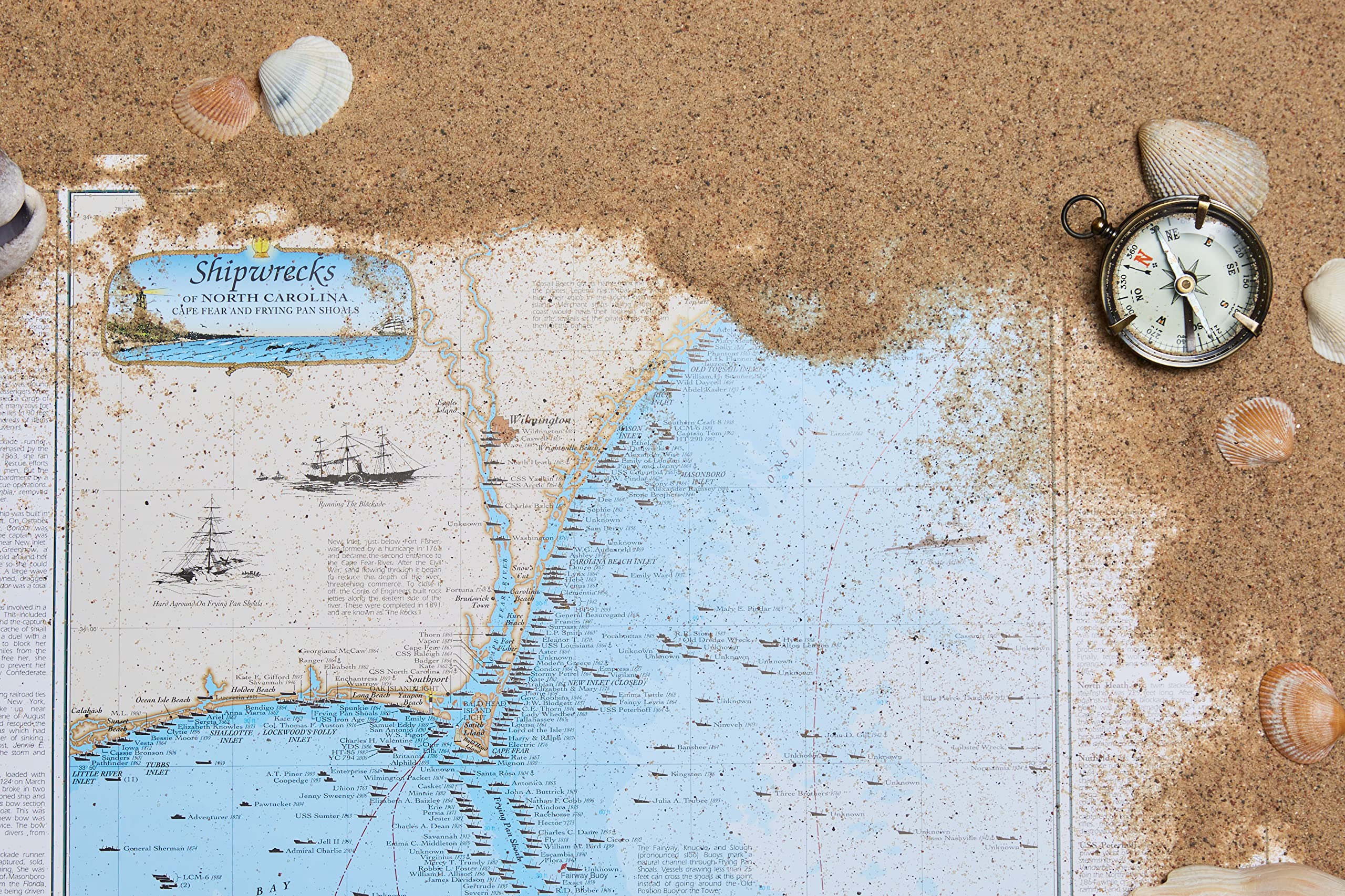
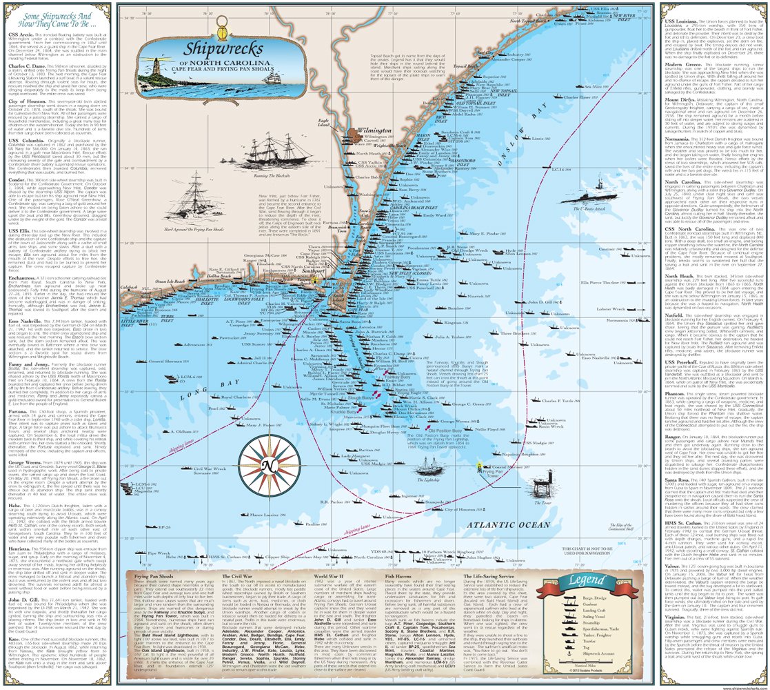
The Sealake Products North Carolina Shipwreck Chart is a meticulously crafted paper chart measuring 18.5" x 20.75". It features hundreds of historically accurate shipwrecks in the Cape Fear area, making it a perfect blend of art and maritime history, proudly made in the USA.
D**.
Great! Fast shipping and excellent packing
Great! Fast shipping and excellent packing!
F**T
Beauty + Authenticity
This map is incredibly beautiful, even more so in real life than on the screen here. This is that rarest of combinations: fine art and excellent cartography. I have searched the net wide for shipwreck maps and I can guarantee you that nothing else I found comes close to these for looks and accuracy. Plus, they are beautifully laminated. A 73 year-old reviewer here says the shipwreck dates and symbols are too small for his older eyes. There's a simple solution: get a good magnifier and voila! your problem is solved. I have one of the semi-globe magnifiers such as used in the movie Master and Commander, and I simply set it on my map (which is on a table) and then just move it slowly right along the coastal areas and everything shows up crystal clear. The artist uses silhouettes for shipwrecks and includes dates right on the map for each wreck. Buy it; you'll be glad you did and, like I did, you'll come back for more of this series of shipwreck maps. (I have no link whatsoever to the artist or company selling these. I simply think they are superb and I'd like people to know that.)
H**T
Too small!
It's a great map but much too small to be useful. Barely legible to my 73 year old eyes. I was hoping for something large enough to frame
Trustpilot
1 week ago
1 month ago
