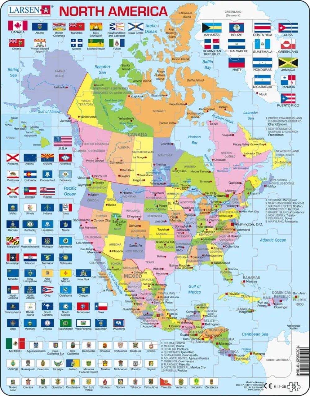
In North America, the 3 largest countries Canada, the United States and Mexico are divided into many states. Canada is the largest country, and the United States is the country with the most inhabitants. This political map has the names of the countries and states, country and state capitals and other important cities, rivers, islands and lakes. The flags of the countries and the many states surround the map. Because the pieces look the same, it is a good idea to study the puzzle carefully to memorize as much as possible before taking the pieces out of the frame. Read the names and look at the colors to find the correct position of the pieces. The puzzle is a challenge for older children and adults, but you can learn a lot.
| Material Type Free | Recycled Cardboard Free |
| Unit Count | 70.0 Count |
| Item Dimensions L x W | 15"L x 12"W |
| Number of Pieces | 70 |
| Item Shape | Rectangular |
| Subject Character | Norway |
| Theme | Map |
| Special Features | Portable |
| Educational Objective | Logical Thinking, Pattern Recognition |
| Skill Level | All |
A**E
The best brand of puzzles!
These are the best puzzles! There are great designs on the background board to give hints for where to put pieces. And they stack flat so they are easy to store! Santa brought us every continent and we are so pleased!
C**.
No stars
Very disappointing puzzle...pieces not shaped like states or provinces....no storage container for keeping the pieces. I do not recommend this puzzle.
Trustpilot
3 days ago
2 days ago